You don't know where to look first
After Storm Vaia (2018), insurers faced simultaneous claims across 40,000+ hectares.
Experts get mobilised where it's limited. Critical zones wait.
The Challenge
After Storm Vaia (2018), insurers faced simultaneous claims across 40,000+ hectares.
Experts get mobilised where it's limited. Critical zones wait.
Post-Ciarán (2023), some assessments took up to 6 months.
The longer the wait, the harder to salvage and to close the claim.
Ground experts and drones are grounded for days after a major event.
Critical areas go unassessed while the damage compounds.
When damage figures are contested, both sides rely on the same field expert.
Without an independent reference, disputes drag on.
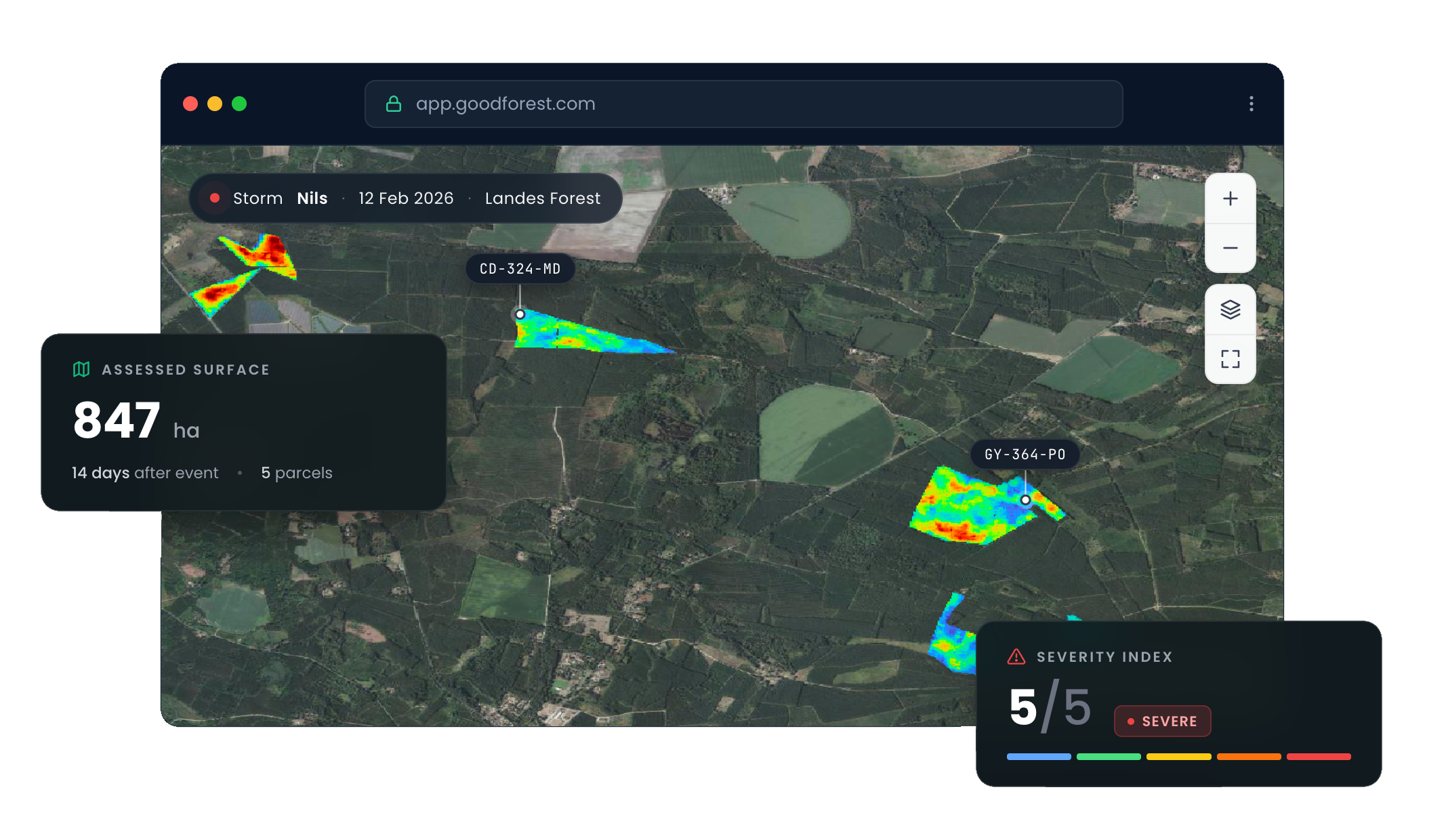
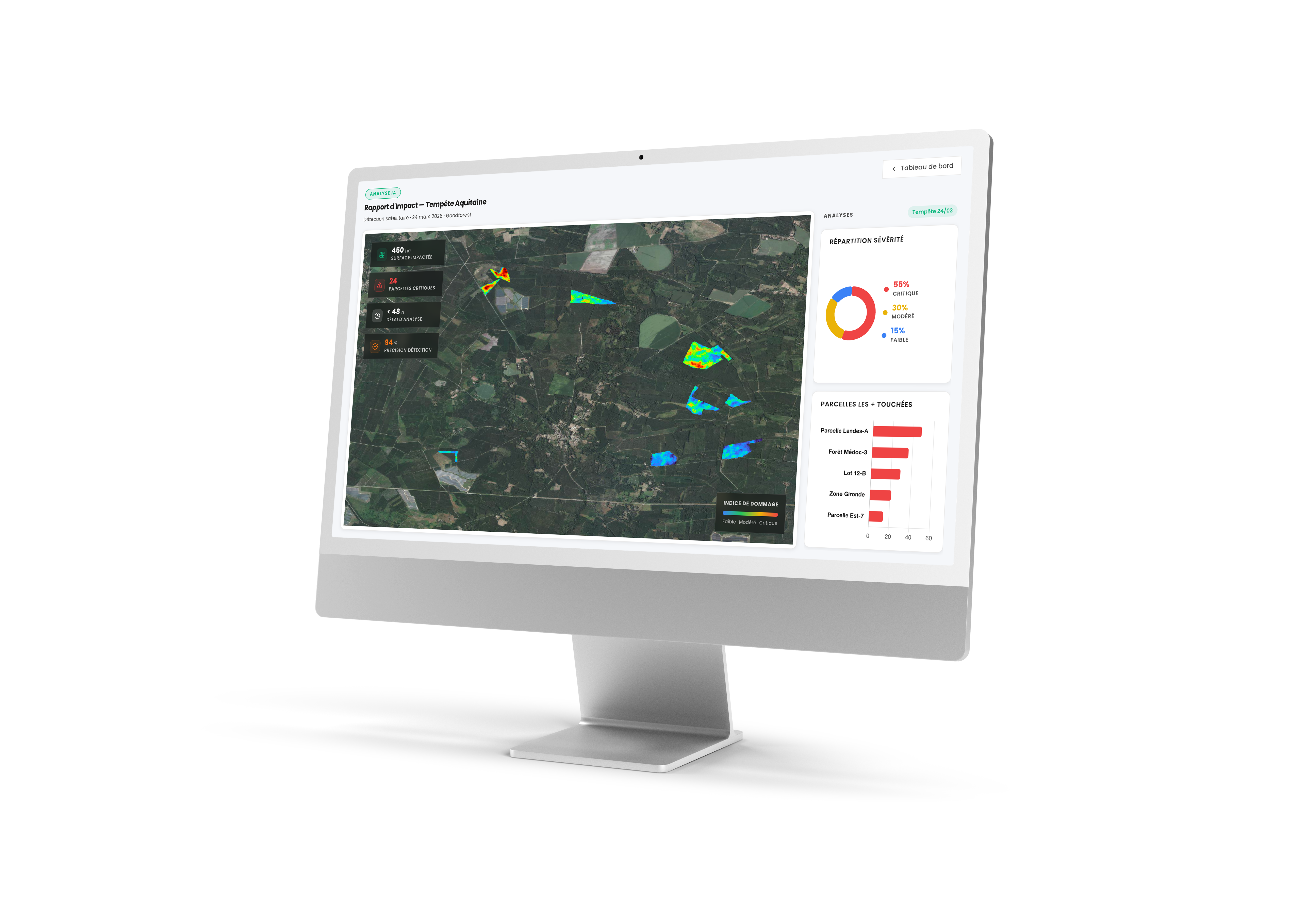
How It Works
Submit the affected area via our platform. No technical setup required.
We turn raw imagery into precise damage data - automatically, at scale.
A damage heatmap and priority zones - ready to use in your claims workflow.
Our Services
Get visibility fast
From €3.5/ha
+ €150 activation fee per claim
Get your damage mapPrecise damage rates by plot
From €10/ha
+ €150 activation fee per claim
Request an assessmentEstimate your cost
All prices exclude VAT · €150 activation fee included
For areas above 30,000 ha, contact us for a custom quote.
Trusted by Forest Insurers
"We were able to reassure our clients quickly, and they knew where they stood before the expert even arrived.
"We sent experts to the right places first. The most critical parcels got assessed faster, which made a real difference for salvage operations.
"It gave us an objective basis for the claims conversation, and helped avoid unnecessary counter-expertise.
FAQ
Delivery time depends on satellite revisit frequency and cloud cover over the affected area. Results are typically available within a few weeks post-event — significantly faster than traditional on-site expert assessment. We'll give you an honest timeline estimate as soon as you submit your perimeter.
Our analysis reaches a granularity of 100 m², allowing precise plot-level damage mapping across your entire insured portfolio.
Yes. We adapt to your existing workflow and report format. API integration is available for teams who want to connect Goodforest directly to their claims management systems. Contact us to discuss your setup.
Yes — our models work regardless of tree species or forest composition. Whether your portfolio includes coniferous, deciduous, or mixed stands, the analysis applies.
Submit your perimeter, get your damage map or full assessment within days.
Start your assessment